Prof. Ni Nyoman Pujianiki Inaugurated with Scientific Oration on Detection of Shoreline Changes with Synthetic Aperture Radar (SAR) Remote Sensing Technology
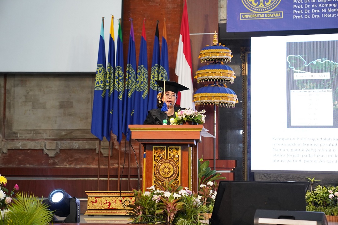
Deputy Director of Academic Affairs and Planning of Postgraduate Program, Udayana University (Unud), Prof. Dr. Eng. Ni Nyoman Pujianiki, ST, MT, IPM ASEAN Eng, was inaugurated as a Professor in the field of Civil Engineering Water Science at the Faculty of Engineering, Udayana University (Unud). In the inaugural ceremony, which took place on Saturday (November 25) at the Widyasabha Room of Udayana University, Jimbaran campus, she presented a scientific oration entitled Mapping Shoreline Changes on Bali Island.
Prof. Pujianiki, in her scientific oration, highlighted that problems in coastal areas of Indonesia are one of the environmental problems that need serious attention. Many infrastructure and cities are built in coastal areas. Therefore, environmental conditions in coastal areas must always be monitored and maintained. One factor in the level of damage to coastal areas can be seen in coastal damage due to abrasion. This can be seen from the shoreline changes that occur in the coastal area. Prof. Pujianiki's research method for monitoring the condition of the coastline in the Bali region is to use remote sensing technology using Synthetic Aperture Radar (SAR) imagery. "I chose to use the SAR type because it has advantages that cannot be achieved if using optical imagery, namely being able to penetrate clouds, being able to take data even in bad weather conditions (day or night can also be used to take data), and having a spatial resolution of 10x10 meters to 15x15 meters," she said.
At the end of her speech, Prof. Pujianiki said
that, considering the importance of monitoring shoreline changes related to
development in coastal areas, researchers hope to collaborate with related
institutions or agencies in the field of research in order to use more
sophisticated technology in exploring coastal area data, especially in coastal
areas with meandering coastlines, so that more detailed data can be obtained
with better resolution. (bmp)
.jpeg)
UDAYANA UNIVERSITY